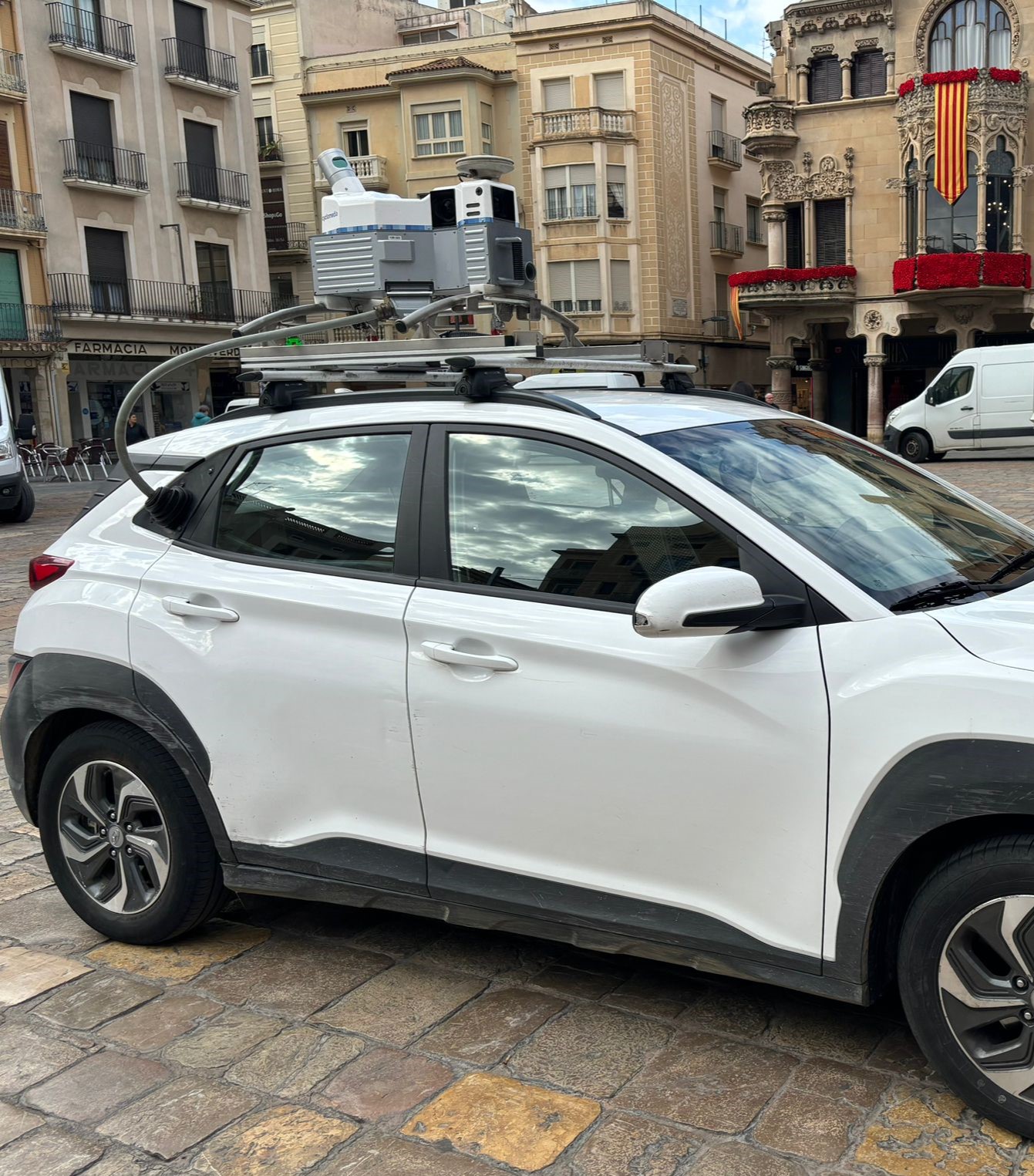
Reus City Council is collaborating with the Institute of Cartography and Geology of Catalonia in the 3DStreets program to create a high-resolution digital version of Reus' streets with different layers of information that can be viewed separately. LICGC is promoting this project to provide councils with a tool to improve public space management and reduce costs associated with inventorying urban elements.
On Monday, April 22, the Mobilmapping software vehicle “3DCarrirs” traveled the streets of Reus, accompanied by a technical crew from the Mapping and GIS Department of the Reus City Council. After collecting data on the streets of Reus, this information will need to be processed and refined so that it can be disseminated and used within approximately 6 months.
The Reus City Council has welcomed the initiative with the aim of continuing to be a standard for its geospatial information. The city council provides citizens with tools such as Rios Geoportalare constantly updated to incorporate more and more functions and more information or data sets, such as the Ortoimatge, which is a metric image of the Reus area, taken from the air, with high resolution and georeferenced, which is made every two or three years.
This Reus Mobile mapping project can be viewed and exploited in the Reus Geoportal, which already has a “3D Environment” tool to manage and exploit it. Mobil Mapping provides digital geographic information of the area with an almost lifelike appearance, where the simplicity of understanding images is complemented by the accuracy of laser measurements taken using ground-based LiDAR technology.
During its tour of Reus on Monday, the ICGC 3DCarriers vehicle mapped all the streets of the urban parcel.
The vehicle uses Mobile Mapping technology that combines photographs and laser scanner data to achieve an accurate measurement. During its journey, it creates a high-resolution digital version of the streets, with different layers of information that can be viewed separately. It is easy for technicians to study elements such as trees present in the municipality, the number and type of urban furniture, elements of vertical and horizontal road signs, facade details, heights of balconies and building facades, shop signs, etc.
Once potential deficiencies are discovered and studied, the information can be used as a basis for developing improvement plans, such as creating more shaded areas or increasing seating on certain streets.
The integration of this information makes it possible to go beyond traditional street vision and provides the possibility to identify, classify and measure visual elements. Once potential deficiencies in the city are discovered and studied, the information can be used as a basis for developing improvement plans, in many areas, such as creating more shaded areas or increasing seating on some streets, etc.

“Infuriatingly humble social media buff. Twitter advocate. Writer. Internet nerd.”


